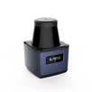


In November 2023, in response to the demand for efficient and stable positioning and mapping from customers, Slamtec introduced the SLAMKit positioning and mapping solution with an industry-innovative product form. This solution is embedded as a software license running on the robot’s main controller, providing the robot with environment modeling and autonomous positioning capabilities.
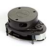
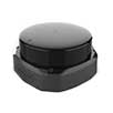
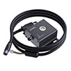
SLAMKit is mainly composed of three parts: the Slamtec LiDAR, the authorization box, and the authorization software program. It aims to provide users with the industry’s first software-licensed navigation system service, ensuring that products are faster, better, and more cost-effective, while offering solutions that fit various scenarios.

The core of SLAMKit is its authorization software. The system block diagram is as follows: the inputs are LiDAR data, authorization box sensor data, and odometer data. The LiDAR data and authorization box sensor data are independently driven by the authorization software, while the odometer data comes from the client’s ROS node. The system’s output can be defined as an upper-layer toolchain available for secondary development, including the visualization interaction tool Robostudio, C++ SDK, JAVA SDK, Restful API SDK, ROS SDK, and more.

Core Advantages of SLAMKit Positioning and Mapping Solution
· High-resolution map construction for large-scale environments
· Slamtec’s proprietary SharpEdge™ map optimization technology
· High-precision real-time positioning
· Robust positioning in dynamic scenarios
· Comprehensive toolchain support with visualization tools and SDKs
· Full lifecycle support services for the product
High-Resolution Map Construction for Large-Scale Environments

Slamtec’s Proprietary SharpEdge™ Map Optimization Technology
The SharpEdge™ map optimization mode perfectly outlines map details, providing smooth details without the need for secondary refinement, allowing customers to apply it directly.

Robust Positioning in Dynamic Scenarios

Comprehensive Toolchain Support with Visualization Tools and SDKs
We provide SDK toolkits including C++, Java SDK, ROS, Restful API, and more, empowering customers to rapidly engage in secondary development. Additionally, we offer RoboStudio, an interactive software available on our official website, enabling offline mapping, map editing, map stitching, and other functionalities.
Full Lifecycle Support Services for the Product
We offer development, deployment, and maintenance services to customers through software licensing, ensuring comprehensive support throughout the product lifecycle.

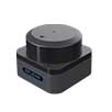
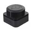
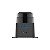
Currently, SLAMKit is available globally through various channels, and developers can acquire the “Developer Version” for free trial. It’s worth noting that the authorization box provided by SLAMKit can serve as both a key for software licensing solutions and independently as an IMU module. When used as an independent IMU module, it offers customers continuous and stable nine-axis sensor signal output, providing an opportunity to experience a high-performance positioning and mapping solution.

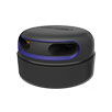
ROS Nine-Axis IMU Module
1. High-precision and stable data output
2. Implementation of anti-zero-drift algorithm for stable yaw angle output
3. Built-in dual IMU with filtering processing algorithms
4. Native USB data output interface
ROS Compatibility and IMU Data Visualization
When the SLAMKit authorization box is used as an IMU, it can read three-axis accelerometer, three-axis gyroscope, three-axis magnetometer, three-dimensional Euler angles, quaternions, and zero-drift heading angle data, helping devices acquire more stable and accurate positioning information. Additionally, it offers 200Hz high-speed multi-dimensional data output.

Commercial-Grade Structure and Hardware Design
Featuring a dust-proof metal exterior and designed to commercial standards, our IMU module ensures efficient and stable performance in commercial application environments.

200Hz High-Speed Multi-Dimensional Data Output
Supporting IMU data output at 200Hz, our module delivers high-frequency positioning and attitude data with excellent accuracy.

SLAMKit & IMU Module Specifications
SLAMKit Positioning and Mapping Solution
SLAMKit positioning and mapping solution is available in two versions: Developer Edition and Professional Edition. Here’s a comparison between them:

ROS nine-axis IMU module data

For more information about the usage manual for SLAMKit and the IMU module, please visit www.slamtec.ai to access the official website and download the experience.